Factors Impacting Cost of Aerial Drone Land Surveying

factors cost aerial land surveying

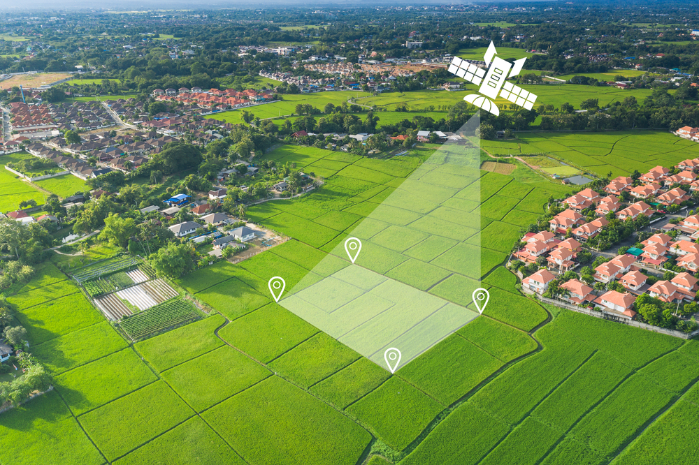
Modern technology continues to impact the world of land surveying in numerous ways, and one of these is the increasing use of aerial drones for various needs. Clients who are considering this format for their land surveying requirements will often have questions, especially if this is their first time using it, and some of these will naturally revolve around the costs involved in this approach.

At Diamond Land Surveying, we use a vast range of approaches to fill all your land and boundary survey needs in Boise and other parts of Idaho, including aerial drones for many projects. These solutions allow for faster, more accurate results that can save time, effort and money in the long run. Which factors will tend to influence the cost of aerial surveying services like these, and how should you be considering them? Here’s a simple rundown.

factors cost aerial land surveying

Basic Dimensions and Lot Size

As you may have naturally assumed, one of the first and most important factors that will influence the cost of aerial surveying services is the size of the lot or area being flown. In general, the larger the area being surveyed results in a higher price.

However, pricing for surveying an area using a drone is significantly lower than historical costs. Using aerial drone technology means that a much larger area can be surveyed in a much shorter period of time, reducing the labor involved with the survey. At the same time drones can capture a significantly greater amount of information or data, potentially making surveys more accurate.

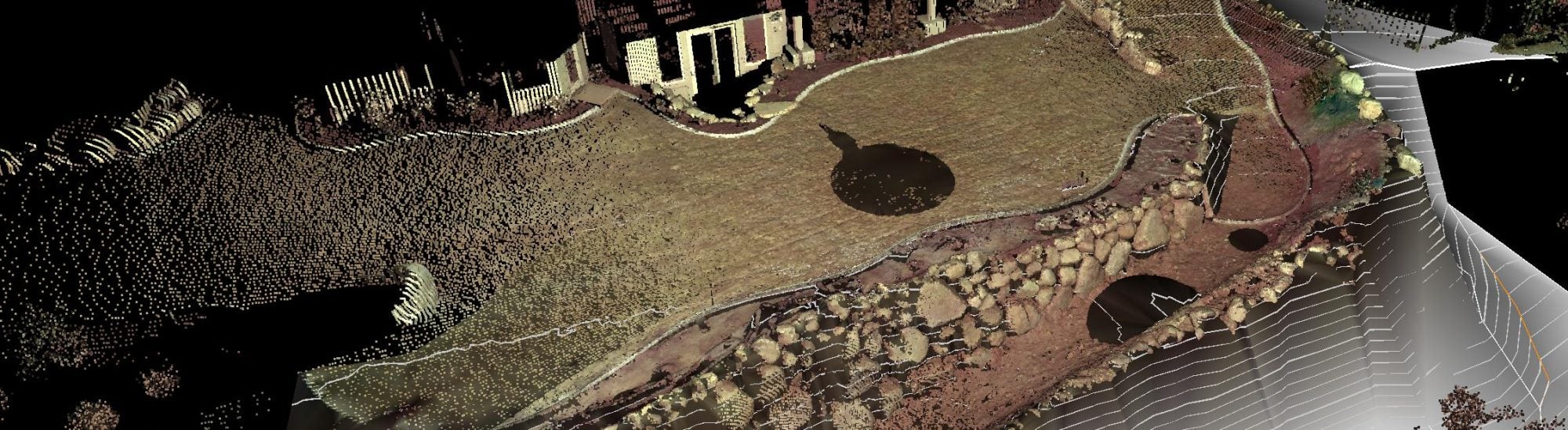
Topographical Details

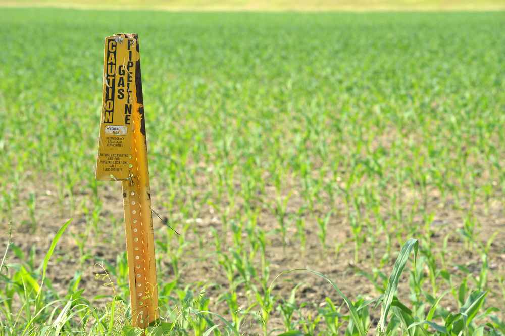
When we talk about topographical details, we mean the land features of the area you’re considering having flown. This will include the kind of terrain they need to cover, vegetation on the site – such as trees and bushes along with their density, and buildings or structures present.

Vegetation density and height play a key role in how much time is spent collecting drone data.

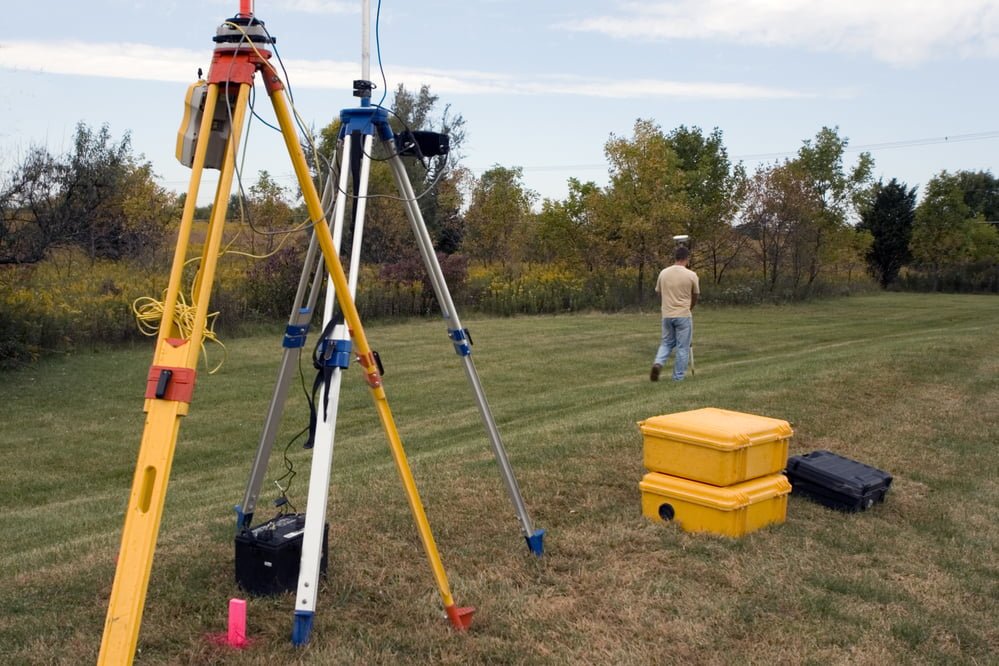
Here’s how. For example, if an area has thick vegetation or structures that will make it difficult for the drone’s camera to see the ground, prices may be higher because the drone data will require supplemental information picked up by a surveyor on the ground using a GPS unit or robotic total station increasing the amount of labor. Level of Detail Needed

Another factor that will affect the cost of aerial drone surveying services is the level of detail needed in the results. If a client is looking for detailed information with measurements taken to greater precision, then this may result in higher costs than if they were only seeking basic data.
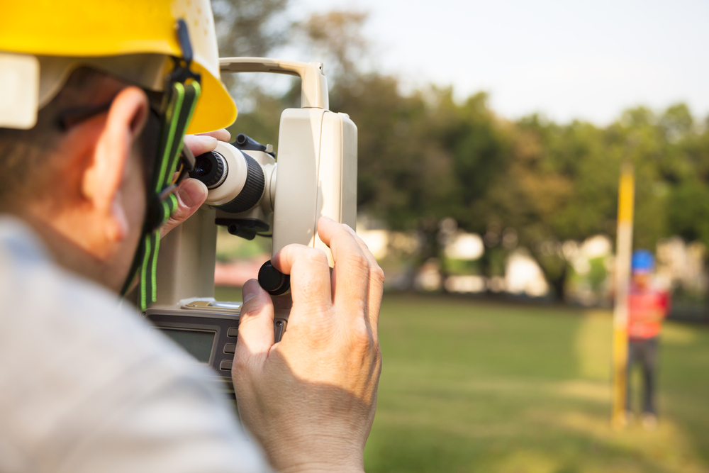
Level of Accuracy

It’s important to realize that “detail” and “accuracy” are not the same thing when it comes to topographical surveys provided by drones. Accuracy is determined by the level of precision with which measurements are taken, and this can vary based on which technologies are used on a project.. In some circumstances drones, used alone, may not achieve the accuracy clients are looking for. When this happens the use of a laser scanner, GPS or robotic total station may be needed. This may result in additional costs to achieve this.

Number and Type of Deliverables Required

In many cases of aerial topography surveys, one of the most significant factors for both timing and cost is the number and type of deliverables required by the client. When we talk about deliverables, we’re referring to various drawings, renderings and reports that are generated from the survey data. The greater the complexity of the area being surveyed and the larger the scope in size of the area will be followed with higher costs in the survey work..

Taking all of these factors into consideration can help you to get a better idea of what kind of cost you’ll be facing when it comes to aerial land surveying. Of course, you should always get a quote from the surveying company before signing any contracts, as prices can vary. It’s also wise to do some research about the company and their experience in this area, so that you can be sure of getting quality results for your money. With careful consideration and due diligence, you’ll have no problem finding the survey services you need.

For more here, or to learn about any of our land or boundary survey solutions for clients in Boise or nearby areas of Idaho, speak to our team at Diamond Land Surveying today.

Forms of Technology Used by Today’s Land Surveyors

technology used land surveyors

Technology has impacted numerous industries and parts of our world, and one that it’s been inescapably beneficial in is land surveying. Modern tech has improved capabilities within numerous forms of land and boundary surveying, allowing for processes that are both more accurate and more efficient.

At Diamond Land Surveying, we utilize several forms of cutting-edge technology for all of our residential and commercial land surveying services, ensuring that we are able to deliver the best possible results. What are some of the chief tech and tools that land surveyors like ours are using in the year 2023, and what are some of the key areas of value these tools add to our industry? Here’s a simple rundown of the technology and tools our surveyors use in Idaho.

technology used land surveyors

Satellite Positioning

One of the most notable forms of modern land surveying technology is the use of satellite positioning systems, such as Global Navigation Satellite System (GNSS). This type of system allows surveyors to gather data more accurately and quickly than ever before.

Through GNSS receivers, surveyors can measure points on the ground with great precision in both two-dimensional and three-dimensional space. This makes for much more accurate data collection and mapping, greatly reducing the amount of time needed to complete a land survey.

Mapping Software

Down similar lines, mapping software is another invaluable tool for land surveyors. Mapping software combines elements of database technology, mapping technology and geographic coordinates to create a powerful data collection tool that can help surveyors analyze the information they are collecting using GPS equipment and other surveying equipment.

This software allows us to store, manage, manipulate and visualize virtually any type of spatial data. This makes it much easier to identify key elements of a piece of land, analyze its boundaries and create accurate maps in the process.

Laser Scanning

In addition to satellite positioning and mapping software, laser scanning is another modern technology that’s revolutionizing the surveying industry. Laser scanners are capable of measuring an area quickly and accurately, making it possible to collect extensive amounts of data in a relatively short amount of time.

Using laser scanning technology, surveyors can produce highly detailed 3D models of the land they are surveying, while also collecting other crucial data points such as elevation changes or location-based details. This makes for a much more comprehensive picture of what the land looks like, and assists land use designers to help make informed decisions.

Unmanned Aerial Vehicles (UAVs)

Another key technological advancement in land surveying is the use of Unmanned Aerial Vehicles, or UAVs. UAVs are small aircraft that are flown remotely by a pilot or an automated system. These vehicles are able to capture aerial imagery of land plots and other areas with great accuracy, allowing surveyors to quickly cover large areas in order to collect data and reach desired outcomes faster.

The most well-known form of UAV is the drone, which has become increasingly popular in recent years. Drones are particularly useful for topographical surveys, large tracts of land and commercial developments needing a high level of detail.

Key Benefits of Modern Tech in Land Surveying

There are several major value-adds that come with the use of these and other forms of technology in land surveying, including:

  • Speed: One of the first benefits to come from modern technology in land surveying is the speed at which surveyors can now work. With more accurate and efficient methods of collecting data, surveyors can get the job done much faster than they would have been able to in past decades.
  • Accuracy: Modern tech also helps to greatly increase accuracy when it comes to surveying land and boundaries. With laser scanning, GNSS receivers and other forms of tech, surveyors can more easily get a comprehensive picture of what they are surveying, ensuring that their data is as accurate as possible.
  • Data storage: Finally, modern technology also makes it easier for surveyors to store and access the data they collect. With digital mapping tools, surveyors can now easily store their data in an organized manner, making it much simpler to go back and access the information when needed.

Overall, modern tech has helped to revolutionize land surveying, making it a much easier and more efficient process. Surveyors can now easily collect data with great accuracy, store and access the information they need, and identify key aspects of land plots in much less time than before. All of this has been made possible by the rise of technology in our world, which is continuing to change the way we view land surveying and other related industries.

And at Diamond Land Surveying, we are proud to make use of the latest in surveying technology, always striving for the highest level of accuracy and efficiency possible. Contact us today if you have any land surveying needs in Idaho!

How Land Surveyors Work With Engineers on Projects

risks DIY land survey

There are many fields where multiple different professionals will provide services for the same project, and a great example here is within any kind of construction or real estate project that includes land surveying. Land surveyors will often work with several other contractors and specialists to aid clients in the completion of their projects, and one of the most common such partnerships is with engineers.

At Diamond Land Surveying, we’re happy to provide a vast range of both residential and commercial land surveying solutions to clients around Idaho – and to work with both clients and other contractors to achieve your project goals. What are some of the basic ways surveyors and engineers often work together to help complete a given project, and what do Idaho clients need to know about this? Here’s a simple rundown.

land surveyors engineers projects

The Basics

From a very broad standpoint, you can think of the surveyor as the one who is in charge of the the data of existing conditions for a project, while the engineer is the one covering the design and implementation of the project’s future state. The surveyor will make sure that they have accurate and up-to-date measurements of the land, while the engineer will ensure that their design meets all applicable standards. They both provide essential services for projects, typically in partnership with one another.

Training

The exact kinds of training each of these professionals has will depend on their specific services offered, but typically engineers are trained in multiple types of land improvement projects – including residential, commercial, and public – whereas surveyors are specifically focused on land surveying services that include understanding the property boundaries and topographical features or improvements. Both also need to understand the applicable laws and regulations for their field.

Timing

One area where these two do differ slightly is within timing. In nearly all cases, site surveyors are called near the beginning of a project, to take measurements and provide the data necessary for the design and construction of each project. Engineers step in next to take the data provided by the land surveyor to design the use of the land.

Now, that’s not to say these two roles never bleed over and take place at the same time – in fact, this is common. Surveyors will often even be called back to a site by an engineer to help with the implementation of their designs.

This starts with the surveyor coming to the site and taking measurements, then the engineer creating plans based on those specifications. The surveyor may also come back to double check any changes that have been made, helping to ensure accuracy throughout the project.

Inclusion of GPS Coordinates

One area that’s become more and more important in both land surveying and engineering is the inclusion of GPS coordinates.Surveyors often provide detailed GPS coordinates for their measurements, in addition to traditional surveying techniques. This helps engineers to more easily design plans that are accurate to the exact location of a given site.

Ensuring the Plan is Being Followed

While many Idaho surveyors may only visit the actual site in the early stages of some projects, that doesn’t mean their work simply ends once the engineer has been brought on board. In fact, surveyors may be asked to come back at various points during a project to take measurements that ensure the plan as outlined is being followed properly.

For many projects, this is part of the original order and is expected from the surveyor. They may be asked to come back periodically and take new measurements, or help to review any changes that have been made along the way – all in order to ensure accuracy throughout the process.

Surveying Teams Often Used

Finally, for anyone looking into a job that may require surveying, it’s important to know that most of the time, surveying teams are used. While surveyors may work independently in some cases, it’s more common for them to work with a team that includes both engineers and other specialists in order to ensure accuracy throughout any given project.

This allows all parties involved to have a better understanding of the project as well as their respective roles within it. This is especially helpful when there are multiple people working on a single project, as it helps to ensure that everyone is on the same page and working together towards a common goal.

Ultimately, both engineers and surveyors play an important role in any Idaho construction or real estate project – but they have different roles and responsibilities within them. It’s important to understand these roles and how they fit together in order to ensure that a project is completed as accurately as possible.

For more here, or to learn about any of our land surveying, boundary surveying and related services for clients around Idaho, speak to our team at Diamond Land Surveying today.

Common Situations Where Boise Land Surveys Are Required

situations land surveys required

The old phrase “you never know what you need until you need it” is often prescient in certain industries, and the land surveying realm is a great example. Such needs often crop up quickly during various settings, and having a great land surveyor on your team in these situations is very important and can save you both time and money.

At Diamond Land Surveying, we’re proud to offer Boise, Idaho’s very best and most comprehensive selection of land surveying services, with solutions ranging from boundary surveys and ALTA surveys to lot consolidations and more. What are some of the most common situations where people often find themselves in need of a quality land survey, and how does a connection with an experienced surveying company like ours benefit you in these settings? Let’s take a look.

situations land surveys required

Dividing Up a Large Parcel of Land

One of the most frequent reasons to call in a land surveyor is when large tracts of land are being divided up. For example, if you are planning on selling individual lots from a large parcel that you own, you will need to make sure that each lot meets the requirements of your local zoning board and subdivision regulations.

A professional surveying company can help you with this task in several ways. First, they can help you to determine the exact size and shape of each lot so that it meets all applicable regulations. Second, they will be able to help you in accurately creating a legal description for each lot, which is important for the future sale or transfer of the property.

Finally, when multiple lots are being divided from a single large parcel, it’s important to make sure that each lot contains an equal amount of land. This can be a difficult task if the original parcel is oddly shaped or sloped, so having a quality surveyor on your side can help make sure that these divisions are done correctly and properly recorded.

Lot Consolidations

On the other end of the spectrum, you may find yourself in need of a land surveyor when consolidating multiple lots into one. This can occur if you purchase multiple properties and then want to combine them all into one larger lot or parcel.

An experienced surveying company like Diamond Land Surveying will be able to help here as well by accurately measuring each individual lot and then combining them into a single larger parcel. This will involve creating the correct legal description for the newly consolidated lot, which is important for future sales or transfers of the property. The process of consolidating multiple lots can be complex and time-consuming, so having an experienced surveying company on your side is crucial to help make sure you don’t overspend or waste time.

Building on Vacant Land

Another situation where a land surveyor can be an invaluable asset is when you are planning on building on vacant land. Before construction begins, it’s important to have your property surveyed in order to develop accurate plans for the project.

One of the key needs here involves meeting local building requirements for setbacks and other regulations. An experienced surveyor can help ensure that all applicable laws are followed, as well as making sure that the property is properly staked and marked before any construction takes place.

A Land Boundary Dispute

One of the most common reasons to call in a land surveyor is when a boundary dispute arises between two or more parties. In this case, an experienced surveyor can help to determine exactly where the boundary line lies and who owns what part of the property in question. This will involve researching title deeds and other records, as well as performing fieldwork on-site if need be.

Having a quality surveyor on your side can help to settle these disputes quickly, accurately, and with minimal disruption to all parties involved. Furthermore, the third-party nature of a surveyor can help to reduce any potential conflicts between neighbors or other parties.

Making Property Improvements

There are also many situations where land surveys are needed even if you aren’t dividing or combining lots. For example, if you are planning on adding a fence, installing a swimming pool, building an addition to your home, or making any other type of improvement to your property it’s important to have it surveyed first.

This is because improvements like this can often encroach on neighboring properties or create potential zoning issues. An experienced surveyor can help to make sure that all necessary regulations are followed to help prevent any disputes with your neighbors.

For instance, if you are planning on installing a new fence, the boundary lines will need to be properly surveyed and marked in order to make sure that it is within your property line and not encroaching on anyone else’s land.

Land surveyors can be an invaluable asset in many different situations, such as dividing or consolidating lots, building on vacant land, resolving boundary disputes, and making property improvements.

If you find yourself in need of a quality surveyor, look no further than Diamond Land Surveying. We have years of experience providing accurate and reliable surveys for all types of situations. Contact us today to learn more about how we can help with your project in Boise or any nearby part of Idaho, or to sit down with our team for a free consultation!

Property Easements, Utility Companies and Important Data

property easements utility companies data

While a given piece of land or property will generally have a single owner, there are several situations where others may have the temporary or permanent right to use, cross or access this land without assuming any ownership. This is a common situation where something called easements are regularly used – they allow for these kinds of basic use and crossing rights when certain situations call for it.

At Diamond Land Surveying, we’re widely familiar with easements and all their applications, and we offer easement drafting as one of our numerous land surveyor services. In today’s blog, we’ll go over what easements are and the purposes they serve, plus several of the resources available that will assist you with easements and who has permission to use your property for distinct purposes – namely professionals like utility company workers or other related fields.

property easements utility companies data

Easement Basics

As we noted above, an easement is used to define the right of a non-property owner to use, cross or otherwise access land. Many of us live with easements on our property without ever knowing they were present.

In the vast majority of cases, easements refer to very specific types of use for those permitted on another’s land. Such use will be considered an interest in the land, but not an occupation or any form of ownership. Easements are often granted to utility companies so they can run their lines across properties, and there are also easement types like preservation easements (for historic areas) or recreation easements (for public development).

So how do you know who might have an easement and permission to use your property? There are a few resources available, which we’ll go over in subsequent sections.

Subdivision Plat

One of the most common property survey formats is the subdivision plat, which contains a number of different basic pieces of information on a basic property map. One such area of information will generally be all easements that were in effect at the time of the creation of the subdivision. In most cases, the plat will also list all the companies or entities who have permission to use the easement areas – this will usually be restricted to utility or similar entities.

Title Commitment

Another document that lists easements is the title commitment, which includes all easements of record in the Schedule B Section II. Included will be the name of the person or company who has the easement granted to them, plus the recorded Deed Book and Page of that document. If the document needs to be accessed, this can be done at the Recorder of Deeds office.

State Programs

In many states, there are free programs offered where assessors will come to your property and locate the actual utility lines or other items on your property. They will then mark these with paint or pin flags so you’re aware of their location.

For more on easements and property use rights, or to learn about any of our boundary or property surveys, speak to the staff at Diamond Land Surveying today.

Real Estate Transactions and Out-of-Date Boundary Surveys

real estate boundary surveys

Within numerous types of real estate transactions or situations, including home sales, boundary disputes and many others, a boundary survey is an important part of the process. Boundary surveys help with everything from defining property lines to placing the proper value on the land tract, and it’s important for the survey used in a given real estate situation to be accurate and up-to-date for these reasons.

At Diamond Land Surveying, we’ve provided numerous residential surveyor services to the real estate world over our years in business, including everything from standard boundary surveys to ALTA surveys, 3D laser scanning services and many other solutions. In certain cases, title companies involved in real estate transactions may reject the use of certain surveys if they are not up-to-date – let’s go over a few of the specific reasons for rejection here, plus what you’ll have to do to ensure accurate records are used, including the potential for having older survey measures fixed.

real estate boundary surveys

Age of Survey

For starters, many title companies will not use a boundary or property survey that’s past a certain age. This will depend on the title company in question – some may be fine with surveys that are under five years old, but others may be stricter and require a year or even six months for certain projects.

The reasons here are fairly straightforward: Older information is more likely to be inaccurate based on changes to the property since it was carried out. Title companies want to avoid any such risks.

Company Out of Business

In other cases, if the surveying company that originally performed the work is no longer in business, the title company may reject their survey for use on a real estate transaction. This is because a company that’s out of business does not allow the title company to clarify any questions or issues with the existing report, confirming its legitimacy directly from those who performed it.

Changing Property Conditions

Another common reason for a rejection of an older boundary survey is that the conditions of the property in question have changed significantly since said survey was carried out. This can refer to any work that’s been done on landscaping or fencing areas, from porch additions to pergolas, retaining walls or any others. If such work has been performed, it would be unrealistic for the title company to issue a policy based on older, out-of-date information.

No Survey Performed

Finally, there may be cases where only a Surveyor’s Real Property Report (SRPR) is performed. This is not the same as a boundary survey, and the vast majority of title companies will not allow you to use only an SRPR for obtaining insurance coverage. Rather, a legitimate boundary survey must also be performed.

For more on issues with out-of-date boundary surveys in real estate situations, or to learn about any of our land surveyor services, speak to the staff at Diamond Land Surveying today.

Property “Encroachment” and Similar Terms Used by Surveyors

property encroachment terms surveyors

In many cases, property and boundary surveys are performed to help those who own property in a given area precisely define where their boundaries end and those of another property owner begin. Land surveys are commonly used to handle property disputes and similar issues, allowing for precise measurements and detailed reports that carry legal weight.

At Diamond Land Surveying, we’re proud to provide a variety of both commercial and residential surveyor services, from basic boundary surveys to construction staking, lot consolidation plats and many other areas. One term that you may hear some use within the world of properties and boundaries is “encroachment” – but you won’t hear it from our surveyors. Here are some basics on what this term means, why surveyors don’t use it, and the legal interplay at work here.

property encroachment terms surveyors

Encroachment Definition

For starters, let’s take a moment and briefly define what is meant when the term encroachment is used within the realm of property surveys or boundary markers. Generally speaking, it refers to any case where someone trespasses upon property, domain or real estate rights of another. And while “trespassing” in this case can refer to simply walking on a property, it may also refer to areas like extended properties, fences or other markers that “encroach” onto someone else’s property.

Surveyors, Not Lawyers

Now, as we noted above, you will not generally hear our property surveyors use the term encroachment on a regular basis. Why? The answer gets into some of the gaps between the physical collection of boundary data and the legal application of such data.

Property surveyors are here to perform the former service: Collect the data. We perform a physical inspection and identify all items or notable property factors, plus help you define specific boundary lines. Essentially, we help you understand all legal descriptions and conditions of the land.

We do not, however, get into determining the legal ownership of a given property or area. This is something that’s handled by attorneys, who get their raw information from us and then use it to make their arguments. While it’s common to hear an attorney use the term encroachment, then, it is not the place of a surveyor to make that sort of a judgement.

Terms Surveyors Use

Instead of encroachment, you’ll hear different terms from surveyors that might qualify – but again, this will be for an attorney to decide. Such terms include:

  • Overlap: When properties or items extend over or cover part of another property.
  • Hiatus: The area between two surveys whose deeds call out a common property line – but whose survey monuments do not support a shared line.
  • Gore: A strangely-shaped area of land, often a triangle, left between two tracks because of inaccuracies in a previous boundary survey.

For more on property encroachment and similar terms, or to learn about any of our property or land surveying services, speak to the staff at Diamond Land Surveying today.

How Written Legal Descriptions Complement Boundary Surveys

written legal descriptions boundary surveys

When it comes to accurately surveying and assessing a given tract of land, such as a subdivision, there are multiple formats that will generally be used all within the same assessment. Those you’re likely familiar with are areas like residential land surveying, which involve visual diagrams that depict the precise qualities of the property, from boundary lines to elevations and numerous other areas.

At Diamond Land Surveying, we provide a variety of such services, including our residential subdivision surveys and many others, and we’re here to tell you that these visual diagrams – while extremely important and often the foundation of any such survey – are not necessarily the only parts involved. In particular, there’s another element known as a “legal description” – what is this, and how do certain written elements of the survey play an important role? Let’s take a look at some of the basics here.

written legal descriptions boundary surveys

Legal Description Basics

Also known as a property description or a boundary description, a legal description is a written element of the survey that describes the tract of land. It offers basic qualities of the land that will help a surveyor identify a given area, helping convey the property’s location with specific details.

In many cases, legal descriptions are used to help transfer land from one party to another during a sale. Information provided by the legal description should not be considered legal advice, which must come from an attorney, but it can help inform such legal advice in many cases.

Types of Legal Descriptions

Legal descriptions can be written in a couple different ways to help identify property characteristics, including:

  • Recorded subdivision lot: This is a description type common in urban areas, with a reference to the basic lot number, block number, subdivision name plus recording information for the subdivision plat (this is at the Recorder of Deeds). This information makes it easier for surveyors to conduct their work, with adjoining properties displayed on the same plat in an easy-to-read format.
  • Metes and bounds: This description type is less common, but is used in some rural areas to describe strangely shaped land tracts. It uses terms like quarter, section, township and range along with directional markers to help identify properties.

Owner’s Dedication

In addition to the legal description, many subdivision surveys will also include what’s known as an owner’s dedication. This is a section where the undersigned owners of a given property within the survey certify their desire to split the property into lots, streets, parks and other public purposes, allowing for public use of the area.

For more on legal descriptions and how they complement visual boundary surveys, or to learn about any of our property survey services, speak to the staff at Diamond Land Surveying today.

Understanding Property Benchmarks in Topographic Surveys

At Diamond Land Surveying, we’re proud to offer land surveying and related services to a wide range of clients, from homeowners to commercial building owners and even industry professionals like architects and engineers. We offer several specific solutions for this latter group, who often require precise measurements in numerous areas to complete their projects – one such solution is known as a topography survey, also called a topographic survey in many cases.

These surveys cover a few important points, and can be utilized by everyone from homeowners to contractors, landscapers and engineers to identify areas like property slope and contours on the property. Let’s go over their basic purposes, plus one area of measurement where you’ll have a choice between two metrics that are related but different in their final purposes.

property benchmarks topographic surveys

Topographic Surveys and Contour Lines

As we noted above, one of the primary purposes of a topographic survey is to show the contour lines of a given property. Contour lines refer to any areas where the land on the property slopes or otherwise changes elevation, vital information for several potential professionals or even for homeowners in many cases.

Generally speaking, the elevations that are shown in a topographic survey are given in relationship to a property benchmark. This benchmark is a base elevation level that has already been established on the property, serving as a basic foundation for any contours that show up in contrast to it.

Our upcoming sections will go over the types of reported elevation measures and which you should prioritize depending on your needs.

Assigned Elevation vs. Actual Elevation

When a topographic survey is being conducted, it can report the elevation of various contours on a property based on two similar but slightly different metrics:

  • Assigned elevations: In these situations, the surveyor themselves will establish the property benchmark elevation. A common choice here is 100 feet above sea level, though this obviously will vary in places like Utah with much higher elevations. In these cases, the elevations shown on a report are in relationship to the benchmark set by the surveyor.
  • Actual elevation: In other cases, GPS, state plane coordinates or even FEMA benchmarks will be used to set the property benchmark rather than the surveyor’s own choice. In these situations, the report will feature elevations that are the true number of feet above sea level based on the location of the benchmark.

Choosing Between Elevation Measures

It’s important to note that both those elevation metrics are accurate, and showcase any contours or changes in elevation properly. The decision on which to utilize is generally based on what it’s being used for, whether it’s personal use versus specific projects with a utility company or another government office. In the latter case, you generally want to go for actual elevation metrics where possible.

For more on topographic surveys and benchmark elevations, or to learn about any of our property survey services, speak to the staff at Diamond Land Surveying today.

Basics on Property Lot Split Plat Surveys and Creation

property lot split plat surveys

If you’re experienced with land surveying and various property-related elements, chances are you’ve heard of a lot consolidation plat, which helps combine multiple lots into a single parcel for a variety of potential reasons. Did you know, though, that the opposite type of service is also available for many property types?

At Diamond Land Surveying, we offer lot consolidation plats as part of our broad land surveying services. Our pros will explain all of the details involved here to you, including how these services differ and compare to their inverse, the lot split plat. What is the purpose and process for this latter pursuit, and how long might it take if you’re considering attempting it? Here are some basics on the lot split plat for you to be aware of.

property lot split plat surveys

Property Types for Splitting

For starters, know that pretty much any major property type can be split if the conditions are right. This includes residential, commercial and even industrial properties. It also includes property that’s part of an existing recorded subdivision or a tract of land.

General Steps

Here are the basic steps that will be followed if you plan on beginning a lot split plat:

  • Boundary survey pros will perform a basic survey on the property. This survey will be based on the legal description provided by the client in question, most commonly a current property deed.
  • The property owner will use the survey information to identify the location of a new line that will split the lot into two or more separate properties. New lots must meet all zoning and planning requirements in the area in terms of both lot size and frontage.
  • From here, lot split plans will be sent to the municipality or county in question for approval. After this, the surveyor will create an initial lot split plat. Only once property owners, lien holders, and all planning and zoning groups agree on the split will the final version of the split plat be created.
  • The surveyor will set new survey monuments that signal the new property lines. Owners, lien holders and the right representatives from the municipality will have to sign the final plat.
  • Once signed, the plat will be recorded officially. From here, new property descriptions will be given to the property owner.
  • Property owners can contact an attorney or title company to file new deeds for the separate properties.

Timeline for Lot Splits

Generally speaking, a lot split can take between a few weeks and a few months to complete in full. Preparation usually takes a week or two depending on the lot specifics. A big factor here is whether you have to attend a specific meeting to present your request – if you do, the process could take longer due to scheduling requirements.

For more on creating a lot split plat, or to learn about lot consolidation or any of our other property surveying services, speak to the staff at Diamond Land Surveying today.