Technology has impacted numerous industries and parts of our world, and one that it’s been inescapably beneficial in is land surveying. Modern tech has improved capabilities within numerous forms of land and boundary surveying, allowing for processes that are both more accurate and more efficient.
At Diamond Land Surveying, we utilize several forms of cutting-edge technology for all of our residential and commercial land surveying services, ensuring that we are able to deliver the best possible results. What are some of the chief tech and tools that land surveyors like ours are using in the year 2023, and what are some of the key areas of value these tools add to our industry? Here’s a simple rundown of the technology and tools our surveyors use in Idaho.
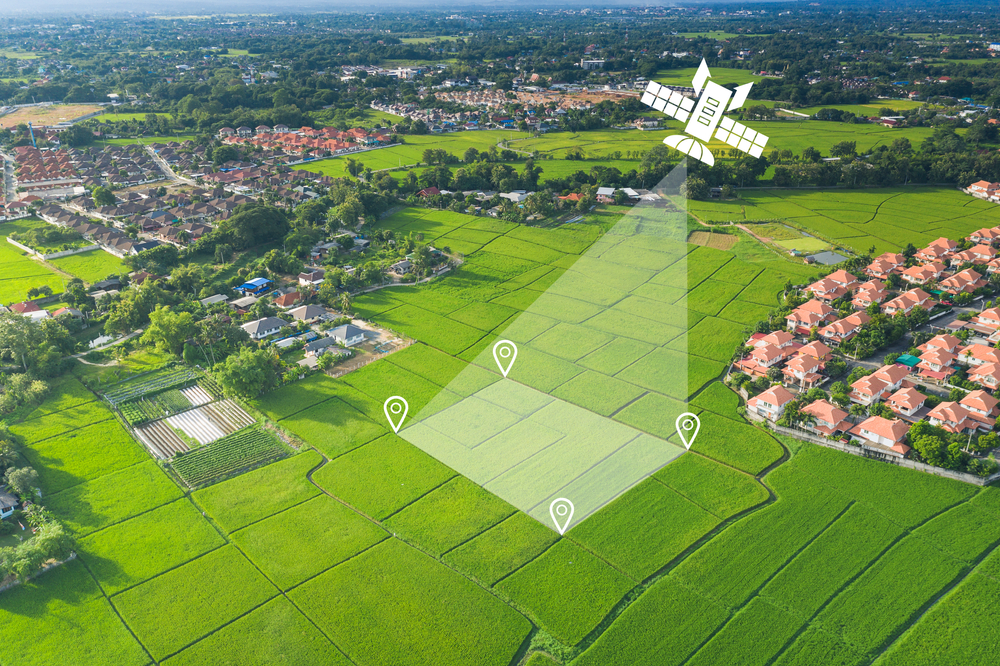
Satellite Positioning
One of the most notable forms of modern land surveying technology is the use of satellite positioning systems, such as Global Navigation Satellite System (GNSS). This type of system allows surveyors to gather data more accurately and quickly than ever before.
Through GNSS receivers, surveyors can measure points on the ground with great precision in both two-dimensional and three-dimensional space. This makes for much more accurate data collection and mapping, greatly reducing the amount of time needed to complete a land survey.
Mapping Software
Down similar lines, mapping software is another invaluable tool for land surveyors. Mapping software combines elements of database technology, mapping technology and geographic coordinates to create a powerful data collection tool that can help surveyors analyze the information they are collecting using GPS equipment and other surveying equipment.
This software allows us to store, manage, manipulate and visualize virtually any type of spatial data. This makes it much easier to identify key elements of a piece of land, analyze its boundaries and create accurate maps in the process.
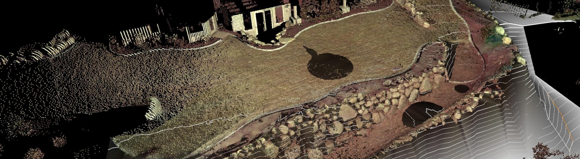
Laser Scanning
In addition to satellite positioning and mapping software, laser scanning is another modern technology that’s revolutionizing the surveying industry. Laser scanners are capable of measuring an area quickly and accurately, making it possible to collect extensive amounts of data in a relatively short amount of time.
Using laser scanning technology, surveyors can produce highly detailed 3D models of the land they are surveying, while also collecting other crucial data points such as elevation changes or location-based details. This makes for a much more comprehensive picture of what the land looks like, and assists land use designers to help make informed decisions.
Unmanned Aerial Vehicles (UAVs)
Another key technological advancement in land surveying is the use of Unmanned Aerial Vehicles, or UAVs. UAVs are small aircraft that are flown remotely by a pilot or an automated system. These vehicles are able to capture aerial imagery of land plots and other areas with great accuracy, allowing surveyors to quickly cover large areas in order to collect data and reach desired outcomes faster.
The most well-known form of UAV is the drone, which has become increasingly popular in recent years. Drones are particularly useful for topographical surveys, large tracts of land and commercial developments needing a high level of detail.
Key Benefits of Modern Tech in Land Surveying
There are several major value-adds that come with the use of these and other forms of technology in land surveying, including:
- Speed: One of the first benefits to come from modern technology in land surveying is the speed at which surveyors can now work. With more accurate and efficient methods of collecting data, surveyors can get the job done much faster than they would have been able to in past decades.
- Accuracy: Modern tech also helps to greatly increase accuracy when it comes to surveying land and boundaries. With laser scanning, GNSS receivers and other forms of tech, surveyors can more easily get a comprehensive picture of what they are surveying, ensuring that their data is as accurate as possible.
- Data storage: Finally, modern technology also makes it easier for surveyors to store and access the data they collect. With digital mapping tools, surveyors can now easily store their data in an organized manner, making it much simpler to go back and access the information when needed.
Overall, modern tech has helped to revolutionize land surveying, making it a much easier and more efficient process. Surveyors can now easily collect data with great accuracy, store and access the information they need, and identify key aspects of land plots in much less time than before. All of this has been made possible by the rise of technology in our world, which is continuing to change the way we view land surveying and other related industries.
And at Diamond Land Surveying, we are proud to make use of the latest in surveying technology, always striving for the highest level of accuracy and efficiency possible. Contact us today if you have any land surveying needs in Idaho!