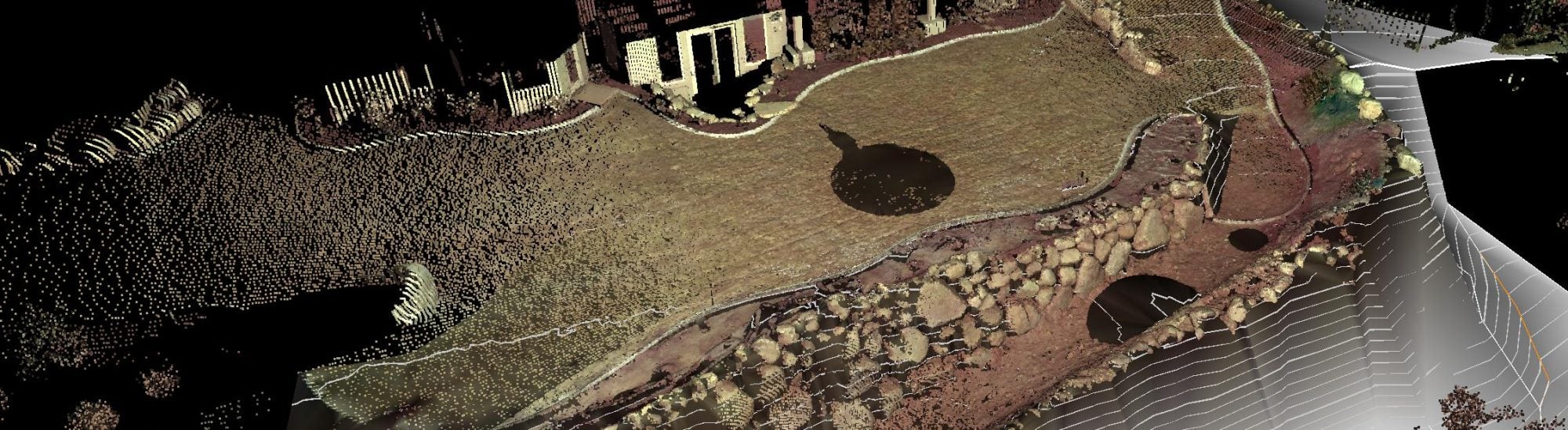
If you’re a home or landowner dealing with things like run-off issues, building on hills or recent elevation changes, a highly valuable tool for you is the topographical survey. This survey gives you a high quantity of information about the land you’re on and various sloping and elevation concerns, allowing you to broadly assess any issues in front of you with adequate information on hand.
At Diamond Land Surveying, our topographical survey services are second to none. We can help with these and other land surveying services throughout Utah, which has a broad range of elevations and slopes to track.
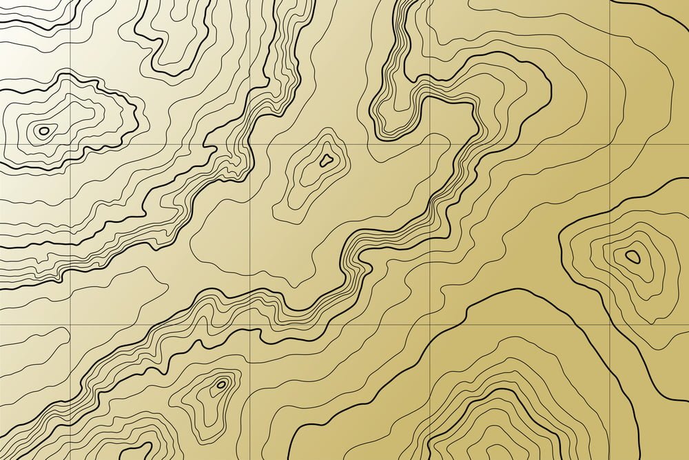
Maybe the most common question we get from land owners who are new to the topographical survey: How is the data we collect expressed visually later on? The answer is in the form of contour lines, which use very basic visual themes to identify peaks and valleys in land. Let’s go over all the basics you need to know about contour lines.
3D on 2D Surfaces
The goal of contour lines in a topographical survey is to represent a three-dimensional image using only two actual dimensions, such as on a piece of paper. To accomplish this, contour lines are drawn up to be closer together or further apart based on the peaks and valleys of the property. Someone reading a diagram of this data only needs to track the proximity of contour lines to each other to understand how steep or flat a given area of the property is.
In our next few sections, we’ll go over some of the basic delineations that are drawn from contour lines on a topographical report.
Gentle Slope Contour
For gentle slopes or even completely flat surfaces on your property, contour lines will appear further and further apart. Many wide contour lines allow for other important property areas to pass through them, such as roadways or pathways. For areas that are virtually completely flat, there will generally be no contour lines at all in those sections of the report.
Steep Slope Contour
As slopes on the property become steeper and steeper, contour lines get closer together. Extremely steep hills, including those approaching 90 degrees, will have contour lines almost touching each other. As hills even out, then, they will add a bit more spacing between each line.
Hill Contour
When mapping out specific hills, topographical surveys will use circle rings for the top of the hill – the highest point in a given area. As the base of the hill is larger than its peak, the contour swill spread out as you move out further and further.
For more information on topographical surveys and how to read and interpret them, or to learn about any of our land surveying services, speak to the pros at Diamond Land Surveying today.